


Baja California Is Slowly Breaking Away from the Mainland and May One Day Become an Island
Don't worry, you won't be around to see it.


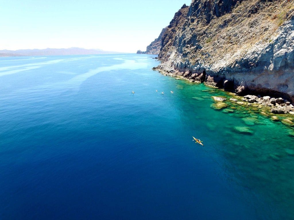
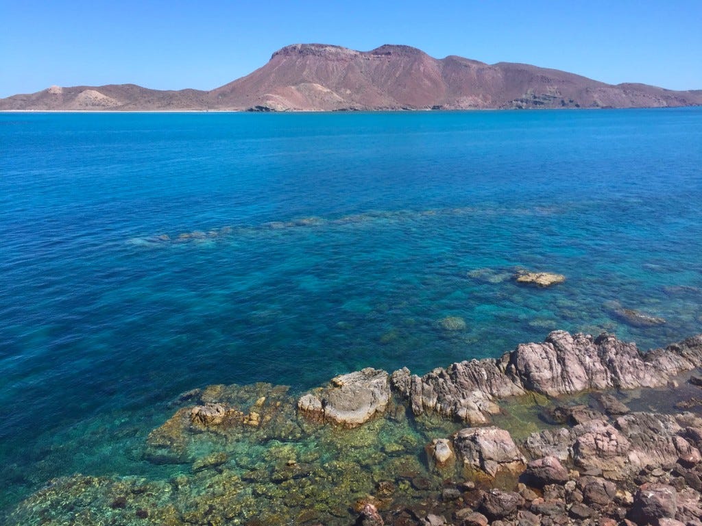
Geological forces are always at work, reshaping the planet, just usually on a timescale too slow for us to notice. But over the long haul, they can completely transform places we think of as fixed and familiar, like Southern California and northern Mexico. I’ve been down to Baja a bunch of times, including a few unforgettable multi-day kayak trips in the Sea of Cortez. Paddling past sheer cliffs and sleeping on empty beaches under the stars, it’s easy to feel like the landscape has been frozen in time. But that sense of permanence? It’s an illusion.
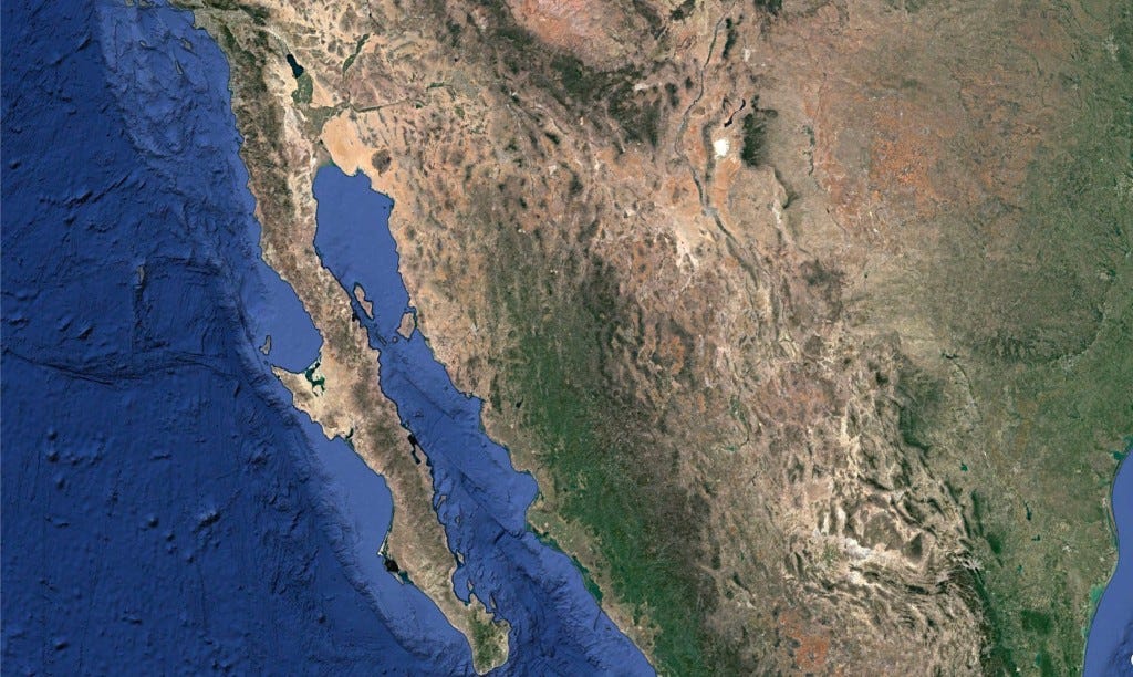
Baja California stretches like a crooked finger pointing toward the tropics, wedged between the restless Pacific and the calm, warm waters of the Gulf of California. This long, skinny slice of land, more than 1,200 miles from Mexicali to Cabo, is full of contrasts: sun-blasted deserts, jagged mountains, hidden oases and mangroves. But it’s not just a finger of land: it’s a fracture. Baja was ripped from mainland Mexico by slow, grinding tectonic forces, the Pacific Plate dragging it north and leaving the Gulf in its wake. And it’s still on the move.
Every year, Baja creeps a little farther away from the continent, slowly widening the gap. Some scientists think that, millions of years from now, the whole rift could flood, turning parts of northern Mexico into a vast inland sea. It’s the continent, cracking apart right under our feet. it's just taking its time.
This process is linked to the activity of the San Andreas Fault and other associated fault systems, which collectively form a boundary between the Pacific Plate and the North American Plate. The movement of these tectonic plates is a slow but relentless process, occurring over millions of years. (Slow, and yet as we've documented, there's been quite a bit of movement over that long period of time).
The Pacific Plate is moving northwest relative to the North American Plate, and the San Andreas Fault system primarily accommodates this movement. In essence, the Baja California Peninsula is moving with the Pacific Plate alongside and away from the North American Plate.
The separation is taking place at an average rate of about 2 to 5 centimeters per year. Over millions of years, these movements accumulate, leading to significant shifts in the geography of regions like Baja California. According to some geologists, within the next 20-30 million years, this tectonic movement could eventually break Baja and the westernmost part of California off of North America to create a vast inland sea, if not an island.
The movement of the continental crust in the area is due in part to seafloor spreading at a massive underwater seam called the East Pacific Rise. This mid-ocean ridge stretches from the southeastern Pacific near Antarctica all the way north into the Gulf of California. Its northernmost extension, known as the Gulf of California Rift Zone, reaches close to the mouth of the Colorado River, helping drive the slow but steady separation of the Baja California Peninsula from mainland Mexico.
That geological rift didn’t just shape the land—it created an entirely new sea. The story of Baja California’s tectonic journey isn’t just about earthquakes and shifting plates, it’s also a story of water. The Gulf of California, also known as the Sea of Cortez, is a geologically young sea, having formed around 5.3 million years ago when the Baja Peninsula began drifting northwest. That rifting process continues today, slowly widening the gulf and redrawing the landscape of northwest Mexico.
This body of water is a critical habitat for marine life, including several species of whales and dolphins that depend on its warm waters. Jacques Cousteau, the famous French oceanographer, famously referred to the Gulf of California as "the world's aquarium" due to its vast array of (declining) marine life.
The Sea of Cortez today is under threat from our short time so far on the planet. Unfortunately, overfishing and pollution, including nitrogen-rich runoff from the Colorado River, which (sort of) flows directly into the gulf, imperils wildlife. Nutrient flows can lead to a dramatic decrease in oxygen, depriving plants and animals of the life-giving gas. The potential extinction of the critically endangered vaquita (Phocoena sinus), represents one of the most urgent conservation crises in the region. The vaquita is the world's most endangered marine cetacean, with estimates suggesting only a few individuals remain. This dire situation is primarily due to bycatch in illegal gillnets used for fishing another endangered species, the totoaba fish, whose swim bladder is highly valued in traditional Chinese medicine.
Habitat destruction is another growing concern, as mangroves, estuaries, and reefs, vital for the breeding and feeding of marine species, are increasingly destroyed to make way for tourism infrastructure and coastal development. Climate change intensifies these problems, with rising sea temperatures and ocean acidification threatening reefs and the broader ecosystem.
The birth of the Sea of Cortez also has an intriguing connection to a body of water hundreds of miles to the north: the Salton Sea. The Salton Sea, California's largest lake, sits in the Salton Trough, an area geologists consider a "rift zone," an extension of the same tectonic forces at work in the Gulf of California.
As the North American and Pacific Plates continue their slow-motion dance, the area around the Salton Sea may sink further, eventually linking with the Gulf of California. If this occurs, seawater could flood the basin, creating a new body of water significantly opening the Sea of Cortez. As mentioned above, eventually this could lead to the full separation of the peninsula from the mainland. However, such a dramatic event is likely millions of years in the future, if it happens at all. Interestingly, the Salton Sea acts as a mirror, reflecting the past processes that led to the formation of the Sea of Cortez.

The Sea of Cortez stands at a crossroads, shaped by both human impact and tectonic drift. Baja California is slowly pulling away from mainland Mexico, a process that could one day create a vast inland sea and dramatically reshape the region. While no one alive today will witness the full transformation, its ultimate impacts could be extreme—redrawing coastlines, shifting ecosystems, and isolating parts of southern California and Mexico in ways we can scarcely imagine.
That is interesting about the Sea of Cortez flooding into the Salton Trough eventually. We won't be around to see it, but humans may have seen such events like the filling of the Black Sea.
I remember when I was a kid I saw an article in National Geographic that said this island-in-the-making will be off of the Oregon coast in 96 million years.